
Data management, analysis, and presentation of infrastructure inspection imagery captured via drone or any camera. Increasing human safety whilst enhancing efficiency.
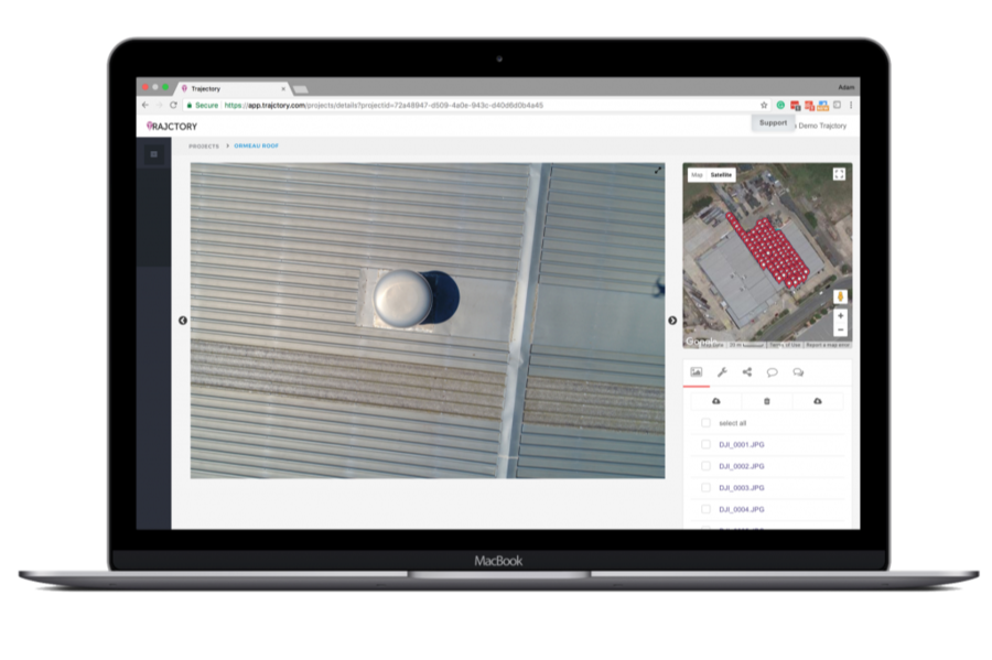
Trajctory was built with the need for better imagery management for large-scale aerial inspections, such as factory or shopping center roofs, power transmission lines, cell towers, etc. With these projects in mind, know where the image was taken in relation to the asset/infrastructure is key for quick detailed analysis.
The system is designed to not 'stitch' imagery together which can lose critical data necessary for identifying concerns.
Trajctory currently scores 59/100 in the Construction category. This is based on user satisfaction (100/100), press buzz (18/100), and other relevant information on Trajctory gathered from around the web.
| The score for this software has stayed the same over the past month. What is this? |

Product recommendations, vendor rankings, market overview and tips on how to select Construction software for business. Published in July 2025.
This software category covers solutions that focus on project management, workflow tracking, asset management and other functions related to construction projects. Good structure and organization are key factors for any construction company and relying on t...
FREE DOWNLOAD Construction-Software-Buyer-Guide-2018.pdf